
Pilot portfolio
Here, you can browse the full Frontier Tech pilot portfolio.
Filter by sector, technology, and geography by using the dropdown menus below.
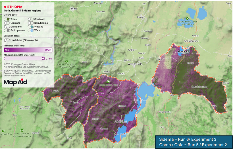
MapAid: Predicting Groundwater Depth
Can machine learning predict groundwater levels accurately enough to reduce failed well drilling in drought-affected communities across Ethiopia?
Mekong at Risk
Can satellite-based mapping and hydrometeorological data identify communities exposed to mining contamination and guide targeted interventions?

SWaDE: Satellite-based water demand estimation
Can AI make solar mini grids a more reliable energy source for powering irrigation in Ethiopian farms?

Evidence for accountability: remote sensing to prevent the environment from harms
Can we use technologies to detect environmentally damaging activities and hold governments accountable?

Smart Mobility
Can alternative transportation solutions improve accessibility in urban Kenya?

Using AI to scale access to forest carbon markets
Can AI successfully analyse satellite images of forest cover and provide a more accurate calculation of carbon levels in Tanzanian forests?

Using climate change scenarios to inform community-based adaptation and planning in Nepal
Can geospatial data on climate change scenarios adequately inform community planning on activities that aim to support the local environment?